Log in
All resources
Create a design
384 Free Artworks of Topographical Map
maps in the library of congress
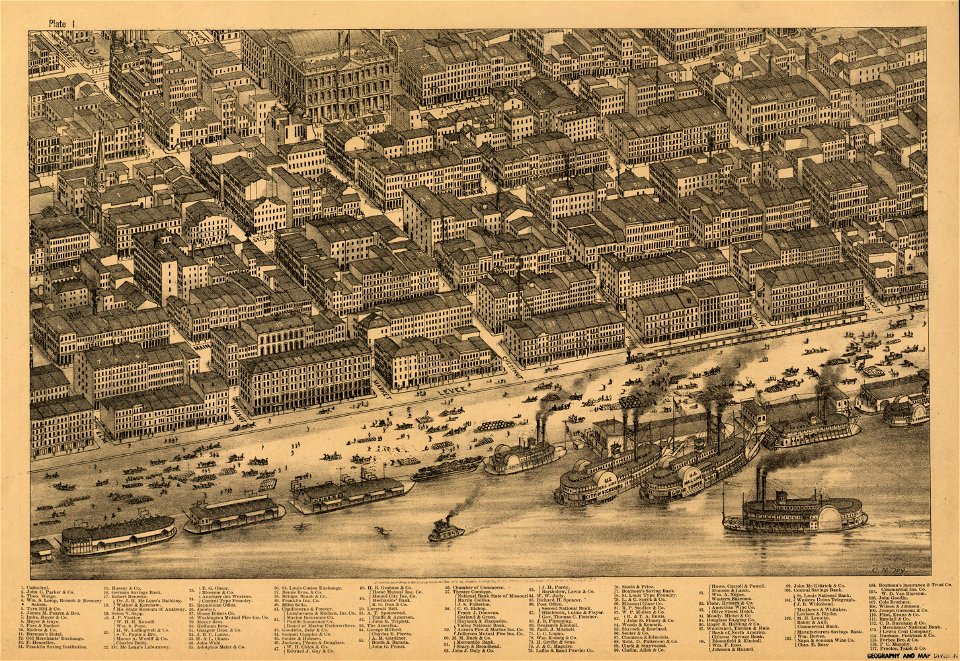
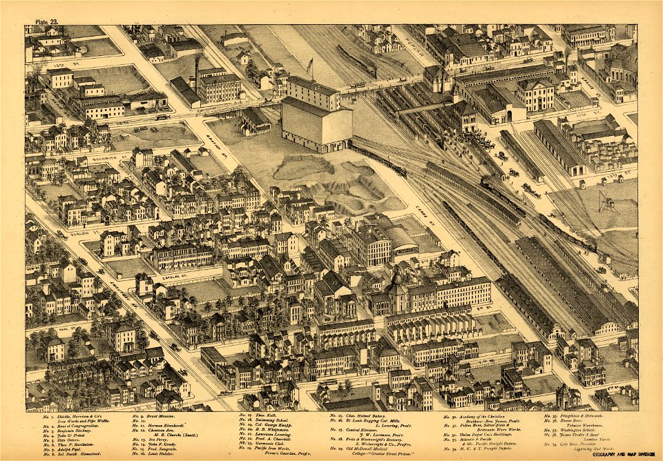
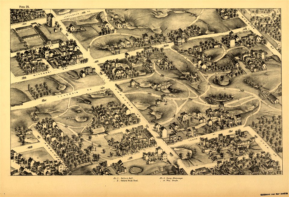
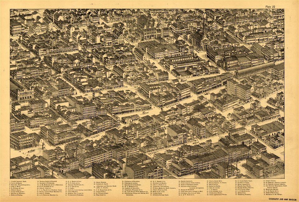
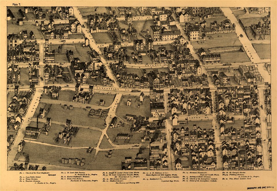
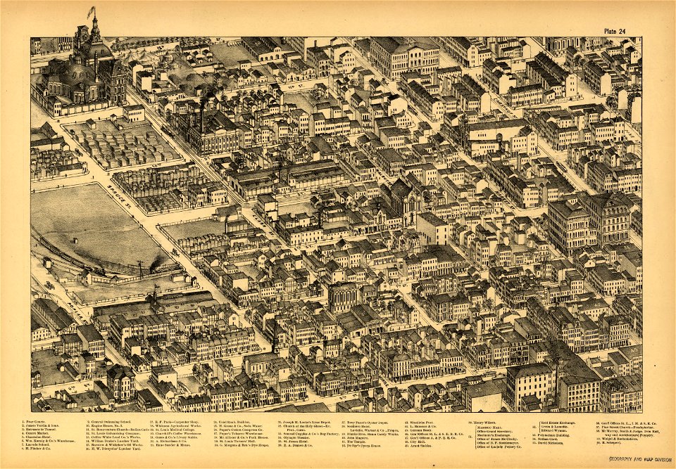
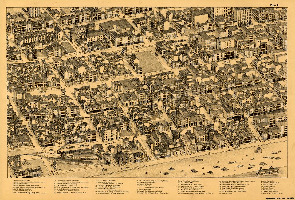
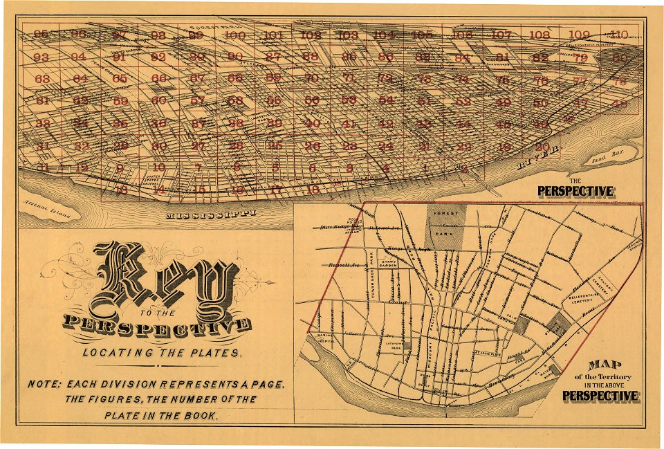
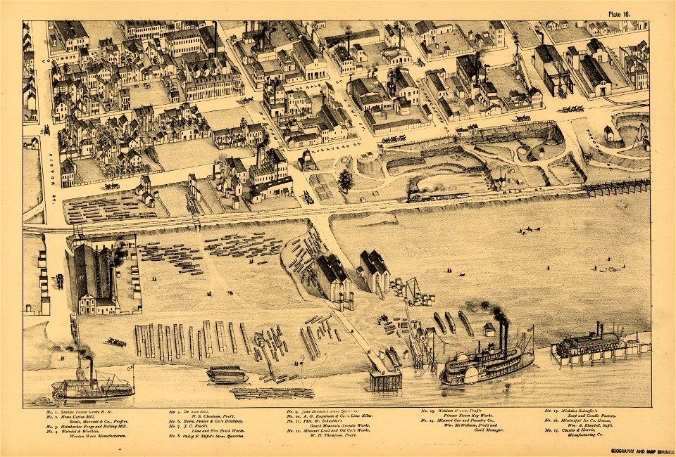
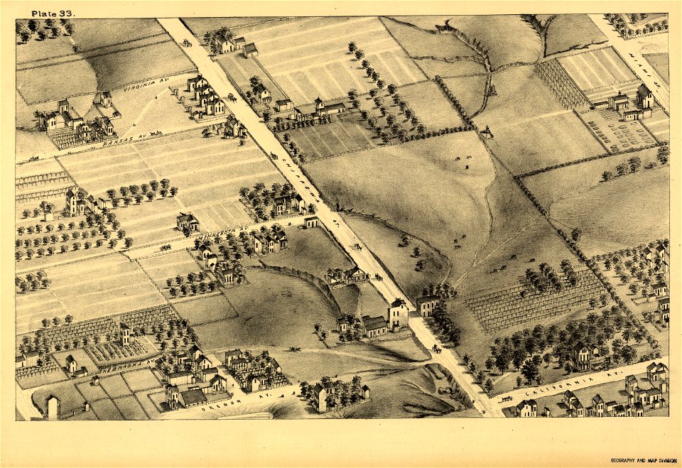
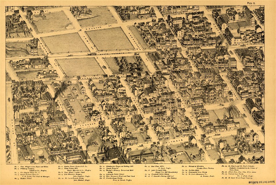
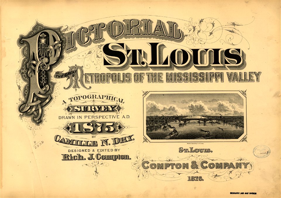
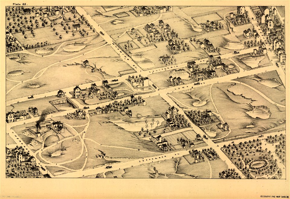
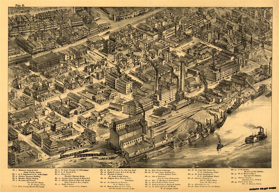
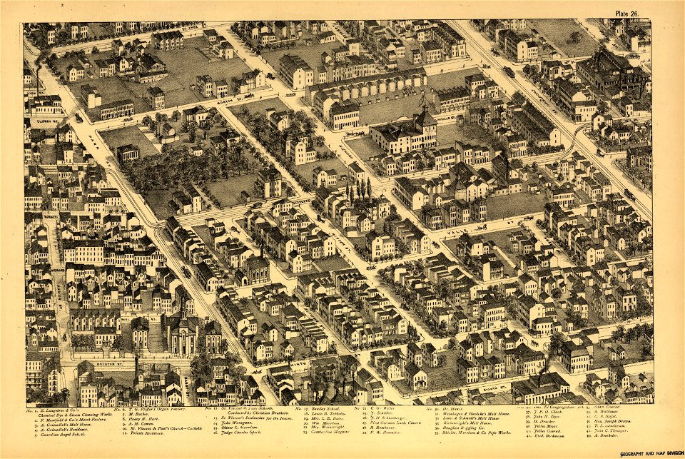
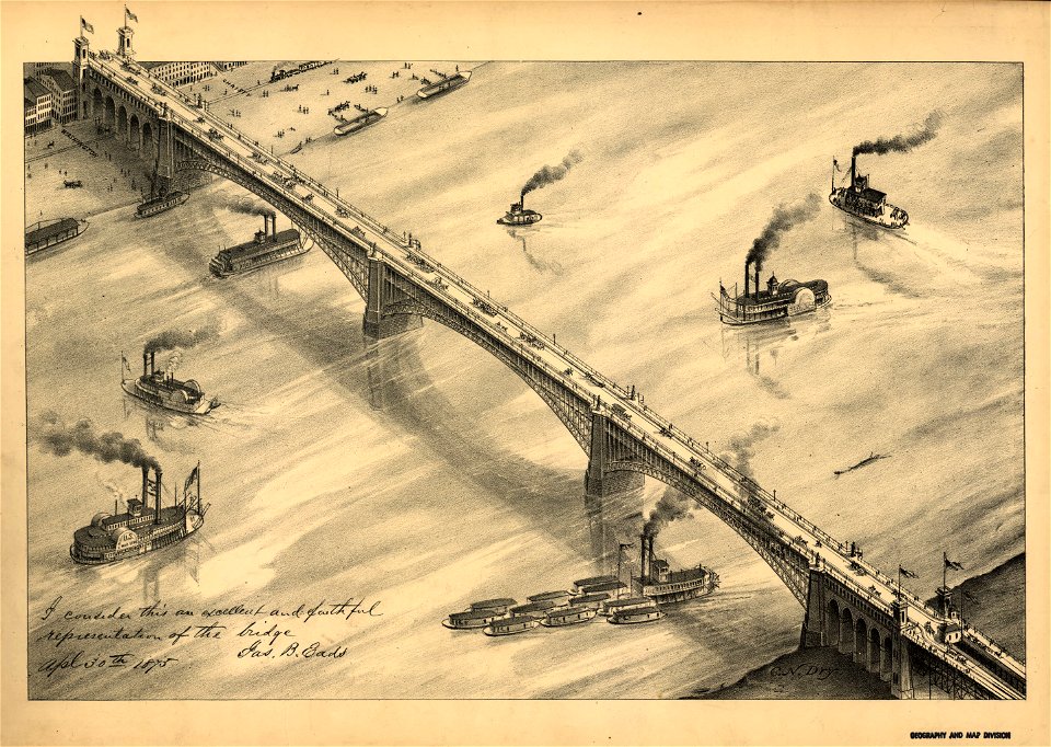
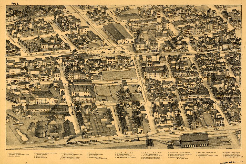
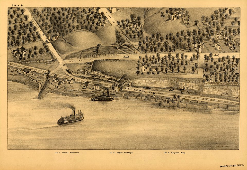
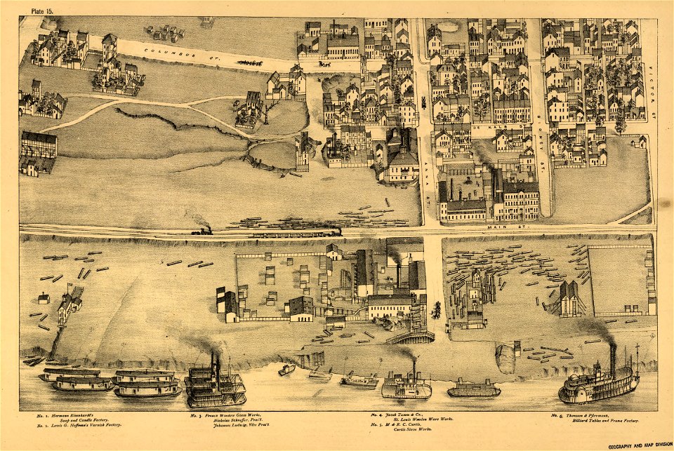
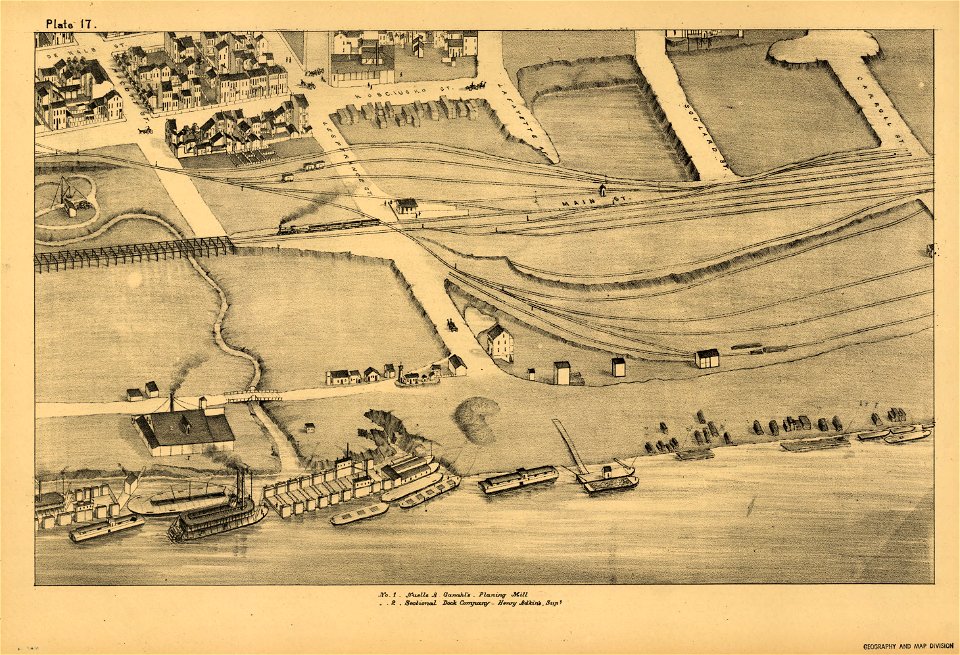
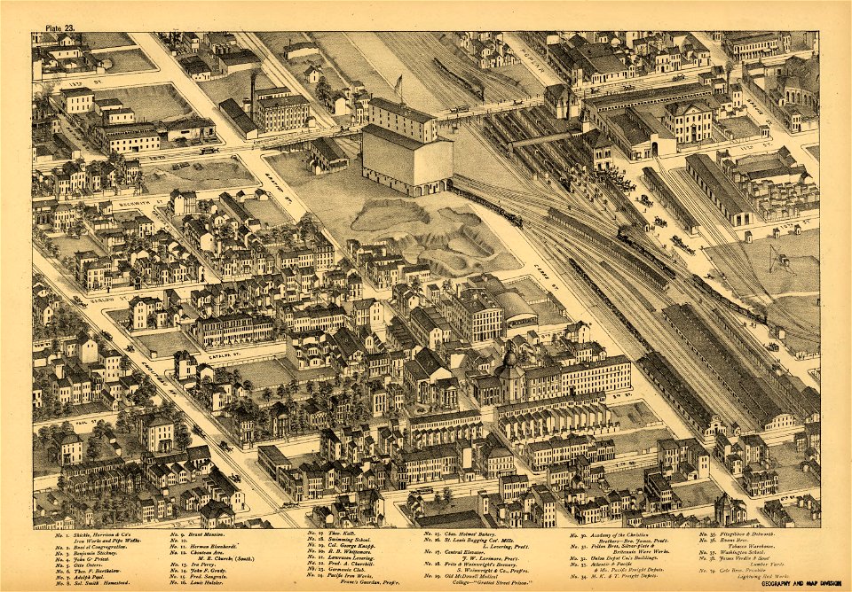
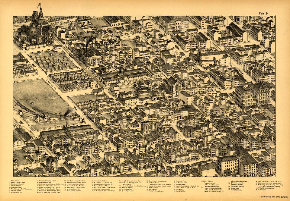
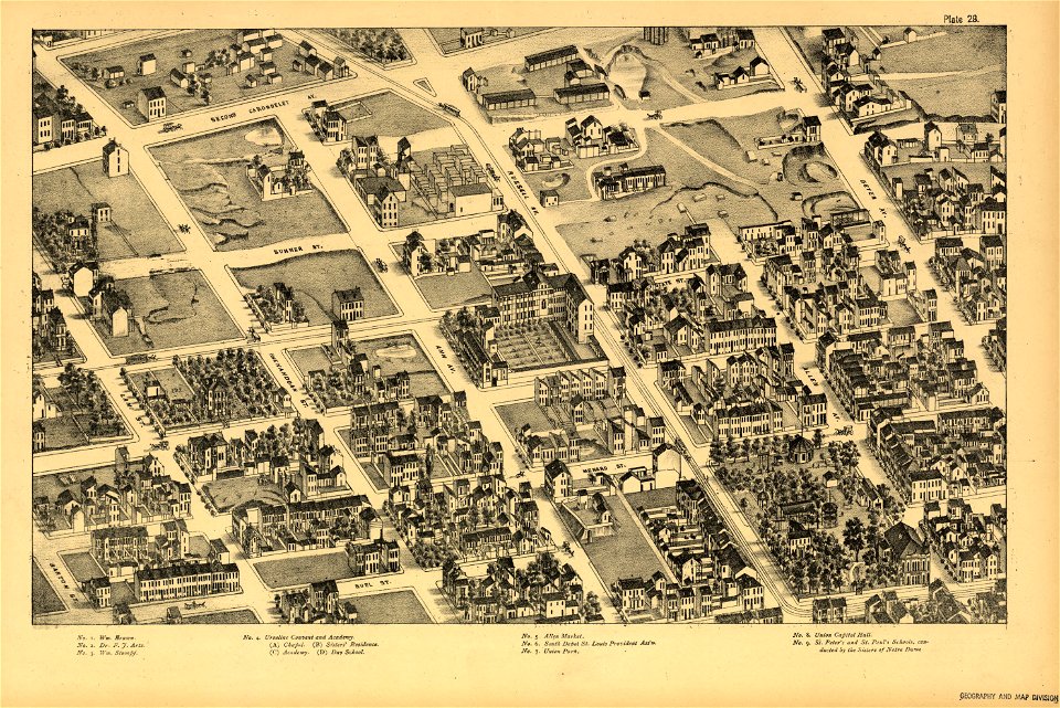
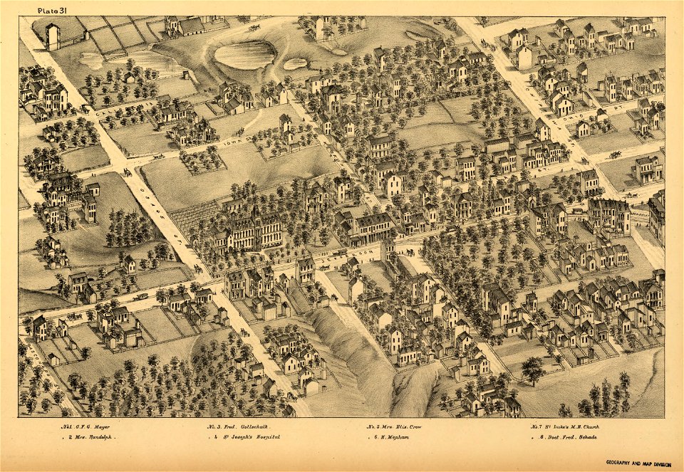
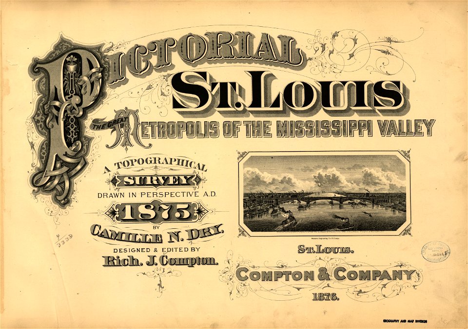
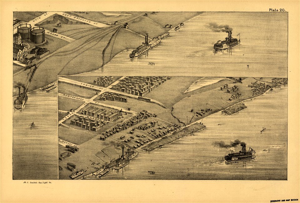
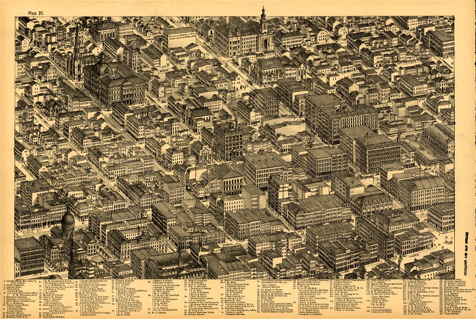
pictorial st. louis
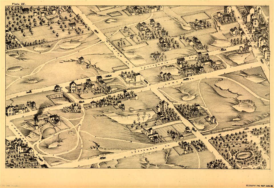
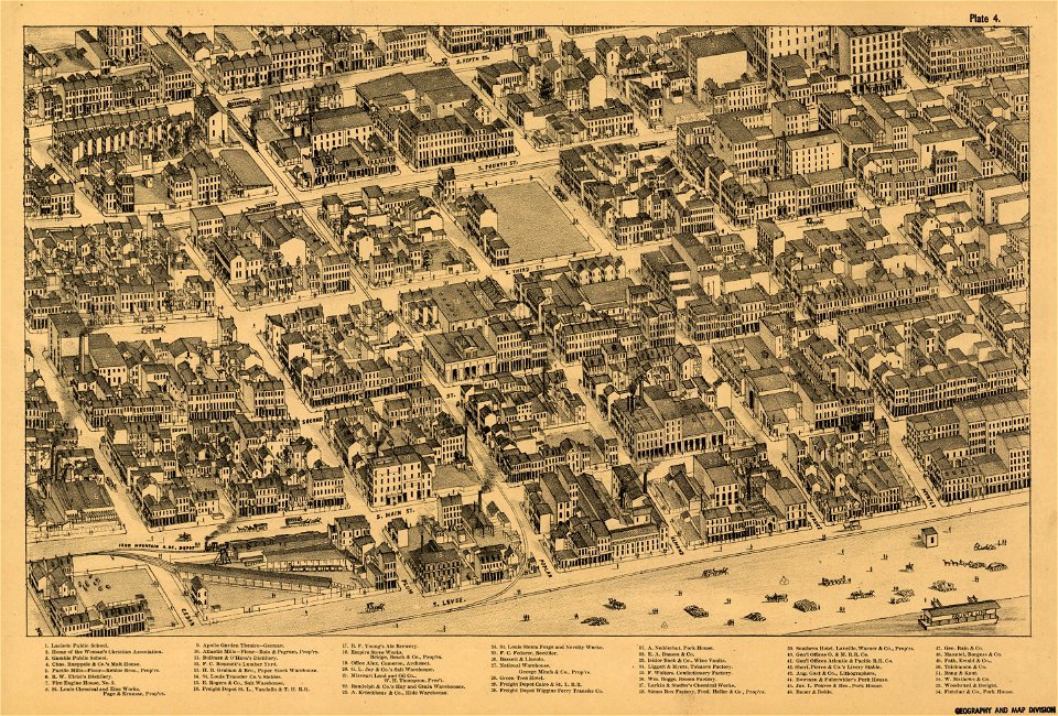
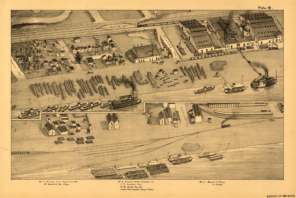
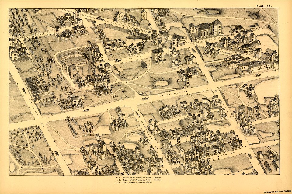
the great metropolis of the mississippi valley; a topographical survey drawn in perspective a.d. 1875
bibliothèque nationale de france
mappa geographica novissima regni hungariae, - divisi in suos comitatus cum districtibus jazygum et cumanorum banatus temesiensis ejusque districtuum nec non regnorum croatiae sclavoniae dalmatiae magni... - btv1b532332906
tranquillo mollo
topographic maps made in 18th century
atlantis magni tomus quintus (biblioteca comunale di trento)
topographischer atlas der schweiz
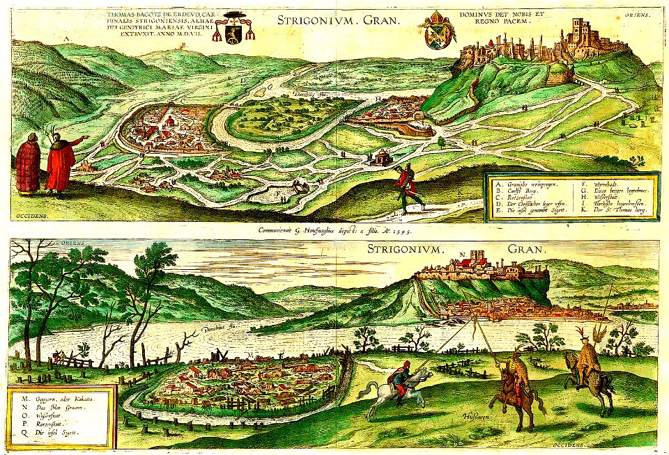
maps and topographical views by joris hoefnagel
maps in the library of congress
pictorial st. louis
maps in the library of congress
pictorial st. louis
maps in the library of congress
pictorial st. louis
maps in the library of congress
pictorial st. louis
maps in the library of congress
pictorial st. louis
maps in the library of congress
pictorial st. louis
maps in the library of congress
pictorial st. louis
maps in the library of congress
pictorial st. louis
maps in the library of congress
pictorial st. louis
maps in the library of congress
pictorial st. louis
maps in the library of congress
pictorial st. louis
maps in the library of congress
pictorial st. louis
maps in the library of congress
pictorial st. louis
maps in the library of congress
pictorial st. louis
maps in the library of congress
pictorial st. louis
maps in the library of congress
pictorial st. louis
maps in the library of congress
pictorial st. louis
maps in the library of congress
pictorial st. louis
maps in the library of congress
pictorial st. louis
maps in the library of congress
pictorial st. louis
maps in the library of congress
pictorial st. louis
maps in the library of congress
pictorial st. louis
maps in the library of congress
pictorial st. louis
maps in the library of congress
pictorial st. louis
maps in the library of congress
pictorial st. louis
maps in the library of congress
pictorial st. louis
maps in the library of congress
pictorial st. louis
maps in the library of congress
pictorial st. louis
maps in the library of congress
pictorial st. louis
maps in the library of congress
pictorial st. louis
maps in the library of congress
pictorial st. louis
maps in the library of congress
pictorial st. louis
maps in the library of congress
pictorial st. louis
maps in the library of congress
pictorial st. louis
maps in the library of congress
pictorial st. louis
maps in the library of congress
pictorial st. louis
maps in the library of congress
pictorial st. louis
london
1841
maps in the library of congress
1861 maps of south carolina
atlantis magni tomus quintus (biblioteca comunale di trento)
topographic maps made in 18th century
maps and topographical views by joris hoefnagel
károly cserna
old maps of georgia (u.s. state)
maps in the library of congress
greece
italy
cornell university library
1888 maps
topographic maps made in 18th century
constantinople
topographical paintings in the centraal museum
16th-century paintings in the centraal museum
atlantis magni tomus quintus (biblioteca comunale di trento)
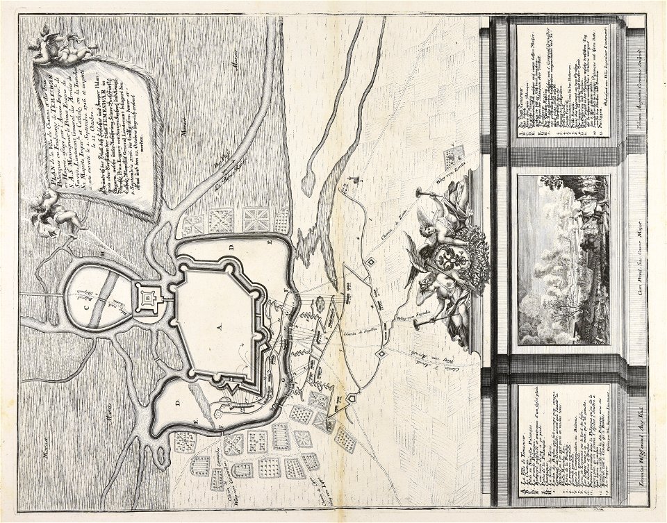
topographic maps made in 18th century
topographic maps made in 18th century
jeremias wolff
topographic maps made in 18th century
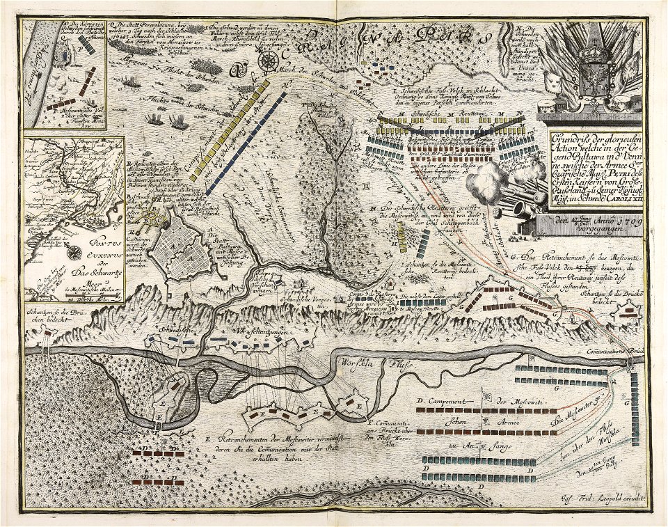
battaglia di malplaquet. 1709
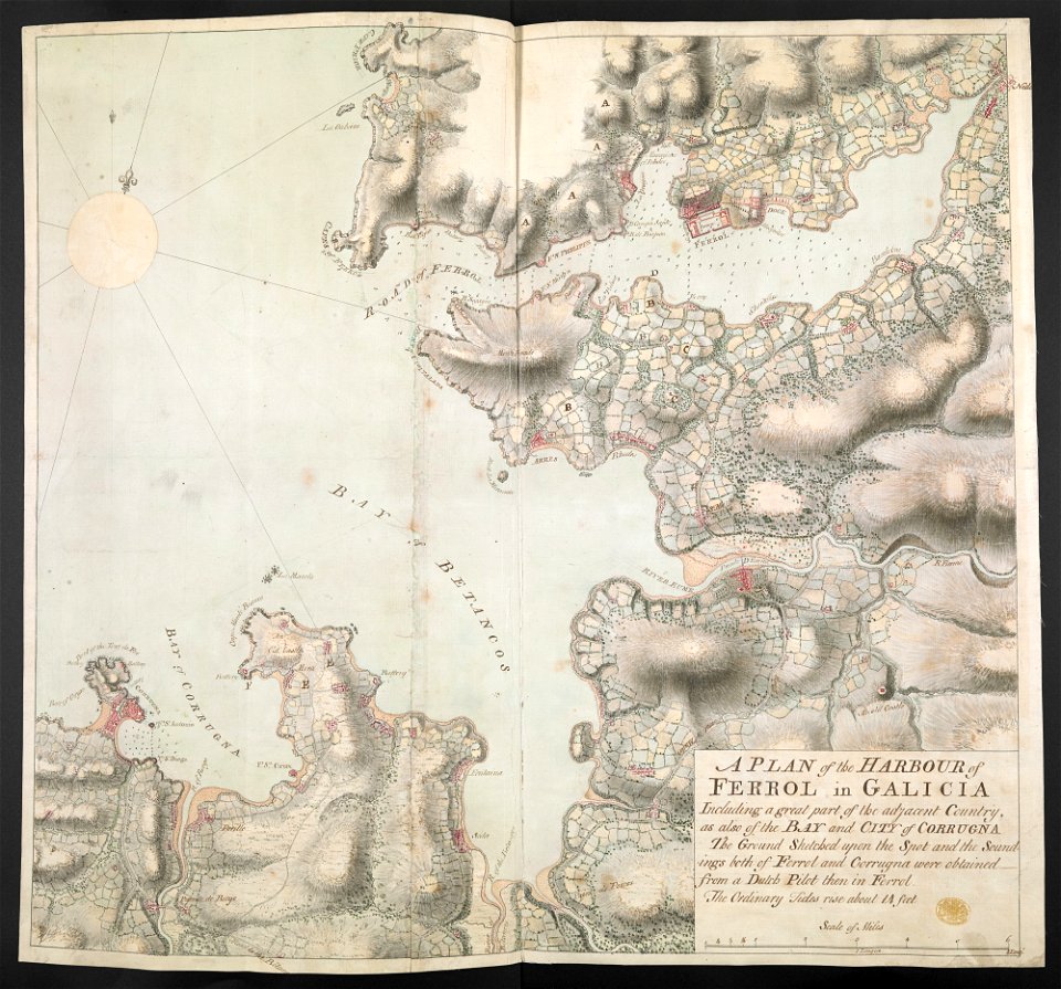
old maps of the province of a coruña
1767 in galicia (spain)
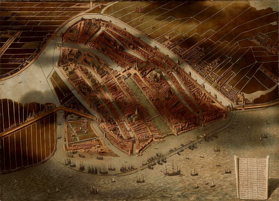
topographical paintings in the amsterdam museum
paintings of amsterdam
topographic maps made in 18th century
jeremias wolff
maps and topographical views by joris hoefnagel
hajduks
maps of arabia quadrangle
mars topography
bathymetric maps of the indian ocean
topographic maps of asia
19th-century maps of southeast asia
aristide-michel perrot
architectonographie des théâtres de paris
maps of paris in the 1830s
topographic map of france, 1864
lemercier & cie.
atlas van der hagen (volume 1)
atlas van der hagen
17th-century paintings of soldiers
lambert de hondt (ii)
old maps of the canton of zürich
türlersee
romania in the 17th century
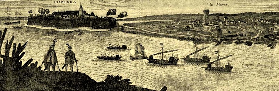
danubius pannonico-mysicus
maps of mountains of cantal
cartes de franz schrader
maps in the library of congress
old maps of new jersey
mappa geographica novissima regni hungariae, - divisi in suos comitatus cum districtibus jazygum et cumanorum banatus temesiensis ejusque districtuum nec non regnorum croatiae sclavoniae dalmatiae magni... - btv1b532332906
tranquillo mollo
mappa geographica novissima regni hungariae, - divisi in suos comitatus cum districtibus jazygum et cumanorum banatus temesiensis ejusque districtuum nec non regnorum croatiae sclavoniae dalmatiae magni... - btv1b532332906
tranquillo mollo
mappa geographica novissima regni hungariae, - divisi in suos comitatus cum districtibus jazygum et cumanorum banatus temesiensis ejusque districtuum nec non regnorum croatiae sclavoniae dalmatiae magni... - btv1b532332906
tranquillo mollo
mappa geographica novissima regni hungariae, - divisi in suos comitatus cum districtibus jazygum et cumanorum banatus temesiensis ejusque districtuum nec non regnorum croatiae sclavoniae dalmatiae magni... - btv1b532332906
tranquillo mollo
mappa geographica novissima regni hungariae, - divisi in suos comitatus cum districtibus jazygum et cumanorum banatus temesiensis ejusque districtuum nec non regnorum croatiae sclavoniae dalmatiae magni... - btv1b532332906
tranquillo mollo
mappa geographica novissima regni hungariae, - divisi in suos comitatus cum districtibus jazygum et cumanorum banatus temesiensis ejusque districtuum nec non regnorum croatiae sclavoniae dalmatiae magni... - btv1b532332906
tranquillo mollo
mappa geographica novissima regni hungariae, - divisi in suos comitatus cum districtibus jazygum et cumanorum banatus temesiensis ejusque districtuum nec non regnorum croatiae sclavoniae dalmatiae magni... - btv1b532332906
tranquillo mollo
mappa geographica novissima regni hungariae, - divisi in suos comitatus cum districtibus jazygum et cumanorum banatus temesiensis ejusque districtuum nec non regnorum croatiae sclavoniae dalmatiae magni... - btv1b532332906
tranquillo mollo
mappa geographica novissima regni hungariae, - divisi in suos comitatus cum districtibus jazygum et cumanorum banatus temesiensis ejusque districtuum nec non regnorum croatiae sclavoniae dalmatiae magni... - btv1b532332906
tranquillo mollo
mappa geographica novissima regni hungariae, - divisi in suos comitatus cum districtibus jazygum et cumanorum banatus temesiensis ejusque districtuum nec non regnorum croatiae sclavoniae dalmatiae magni... - btv1b532332906
tranquillo mollo
1777 maps of new york (state)
maps of the hudson river
st. helena - a physical, historical, and topographical description of the island (1875) by melliss
maps from the mechanical curator collection
old maps of cities in switzerland
maps of biel/bienne
cartes de franz schrader
gavarnie
maps from the mechanical curator collection available to georeference
maps from the mechanical curator collection
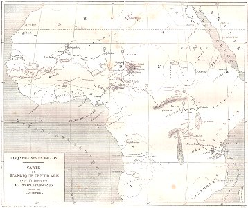
illustrations from five weeks in a balloon by riou and montaut
orientalist painting
st. helena - a physical, historical, and topographical description of the island (1875) by melliss
maps from the mechanical curator collection
19th-century maps of charente
1842 maps
maps from the earth and its inhabitants, vol. xi
algeria in the 1800s
camps topographiques de la campagne de mdcclvii, en westphalie
bornum (hannover)
cuninghame, topographized by timothy pont (1876)
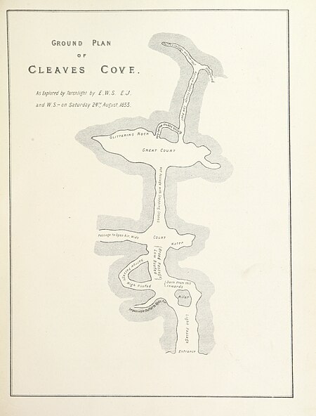
maps of caves in the united kingdom
cuninghame, topographized by timothy pont (1876)
1870s maps of scotland
maps from the earth and its inhabitants, vol. iv
topographic maps of the united kingdom
maps from the earth and its inhabitants, vol. iv
topographic maps of ireland
old maps of the strait of gibraltar
1762 maps of spain
topographischer atlas der schweiz
maps of glaciers of switzerland
maps of county armagh
1760s maps of ireland
camps topographiques de la campagne de mdcclvii, en westphalie
stöcken (hannover)
topographischer atlas der schweiz
palügletscher
r. hausermann, carte de la terre sainte, 1914
eran laor cartographic collection
1777 maps of new york (state)
1777 maps of new jersey
1860s maps of new york (state)
maps showing 1776
maps and topographical views by joris hoefnagel
historical images of louny
old maps of former departments of france
maps from gallica
barcelona in the 1800s
maps by juan lopez
british library king's topographical collection
william henry toms
101 - 200 of 384
Next page
/ 4


![Topographical Map of the Department of Montenotte / Written by the care of Mr. Count de Chabrol Prefect. Scale of 10,000 Meters [=Om. 050; 1: 200,000]; Drawn by Cecchi, geographer, between 1806 and 1812](https://cdn.creazilla.com/illustrations/10000886036/topographical-map-of-the-department-of-montenotte-written-by-the-care-of-mr-count-de-chabrol-prefect-scale-of-10-000-meters-om-050-1-200-000-drawn-by-cecchi-geographer-between-1806-and-1812-sm.jpg)
